
AviSense
See beyond obstacles. Anticipate risks. Act with confidence.
Profile
Legal Name
AVISENSE.AI Technovlastos IKE
Tagline
See beyond obstacles. Anticipate risks. Act with confidence.
Details
AviSense develops AI and augmented reality tools that help people detect hidden hazards, anticipate risks and make safer decisions. We combine information from cameras, sensors and satellites into a clear, shared view, with timely alerts and visual guidance for operators and field teams. Our mission is to make complex environments—such as cities, airports and industrial sites—safer and easier to manage. Our vision is a future where teams have the information they need to prevent incidents before they happen. A spin-off of the University of Patras and Athena Research Center, AviSense combines strong research foundations with hands-on experience in AI, computer vision, sensor fusion and augmented reality. Through Horizon Europe projects, the ESA BIC Greece programme and real-world demonstrations, we translate advanced technology into practical tools that address operational needs.
Classification
Type
Private Company - SME
Size
Micro (2-10 employees)
Category
Data, Applications & Digital Services, Dual-Use & Security Applications, Earth Observation & Geospatial Analytics, Mobility, Maritime & Aviation
Value Chain Position
Downstream
Map
An interactive map showing the organisation's location will appear here.
Send Message
Your Name
Your Email
Subject
Your Message (optional)
Send Message
Contact
Website
https://www.avisense.ai
CONTACT Email
info@avisense.ai
CONTACT Phone
Address
Σταδίου, κ. Πλατανίου, Platani, Municipality of Patras, Western Greece, Peloponnese and the Ionian
Municipal Unit of Rio
Western Greece
Greece
265 04
International Presence
Strategic Focus
Strategic Priorities: Our strategic priorities are to: - Focus on clear operational needs: Prioritise airport and industrial safety as near-term markets, while building on our experience in smart mobility and emergency response. - Advance our core technology: Improve multi-camera perception, sensor fusion and precise localisation to detect hidden hazards and anticipate risks. Develop clearer AR guidance and integrate satellite data where it improves situational awareness. - Make the platform easier to deploy and scale: Build a reliable, secure platform that works with existing cameras and infrastructure, supports real-time processing, and provides intuitive dashboards and field guidance. - Turn pilot results into commercial growth: Use upcoming pilots to demonstrate measurable improvements in safety, response time and coordination, then convert successful trials into paid deployments and recurring revenue. - Strengthen our team and partnerships: Expand engineering and commercial capabilities, build relationships with operators and system integrators, and pursue targeted European partnerships and funding that support product development and market entry.
Looking for Partnerships: We are looking for partners in five main areas: - Pilot and deployment partners: Airports, industrial and energy operators, municipalities and emergency services to validate our solutions in real operating environments and develop measurable safety and operational improvements. - Space and geospatial partners: Earth observation providers, satellite navigation specialists and geospatial platforms to combine satellite and ground-based data for precise localisation, environmental awareness and crisis management. - Technology partners: Camera and sensor manufacturers, edge computing and connectivity providers, and AR hardware companies to support reliable, interoperable and cost-effective deployments. - Commercial partners: System integrators and solution providers with established customer relationships in aviation, industrial safety, smart cities and critical infrastructure, interested in integrating AviSense into joint offerings. - Research and innovation partners: Universities, research centres and European project consortia working on cooperative perception, sensor fusion, explainable AI, risk prediction and intuitive XR interfaces.
Background
Established: 2023-06-21
Projects & Missions: [AutoTRUST] — Horizon Europe: WP6 leader, leading exploitation, innovation/IPR management and standardisation, while contributing AI-based vehicle monitoring and perception technologies. Partners include CERTH and ALKE Electric Vehicles. [CoEvolution]:WP6 leader and automotive pilot co-leader alongside AVL, developing and testing methods that make autonomous vehicle perception more resilient to errors and malicious inputs. [XR-SENSE] — Horizon Europe: Project partner and use-case leader within Pilot 1, contributing AI, cooperative perception and XR interfaces for mobility and safety applications, alongside partners including the University of Patras and IDNEO. X-Ray Mobility — 6G-PATH:Experiment lead and technology developer, integrating multi-camera perception, risk detection and AR guidance with the IT/ALB testbed in Aveiro, Portugal. [SafeDriveXR — 6G-XR]: Technology developer for cooperative perception and real-time XR driver assistance, with field trials conducted at the 5TONIC testbed in Madrid. [XRive — XR2Learn]: Technical partner developing XR-based driver training and evaluating user interfaces for safer interaction with advanced vehicle technologies, together with ENEBULA and InterMediaKT. [TRUST-AI — REINFORCING]: Project leader, working with InterMediaKT to embed responsible, transparent and inclusive AI practices into mobility and driver-assistance systems. [5G-IANA Open Call #2]— completed: Experiment participant that developed and tested cooperative localisation and cross-view geolocation technologies using 5G infrastructure. ESA BIC Greece: Incubatee developing space-enabled localisation and situational-awareness solutions, supported by ESA BIC Greece and Corallia.
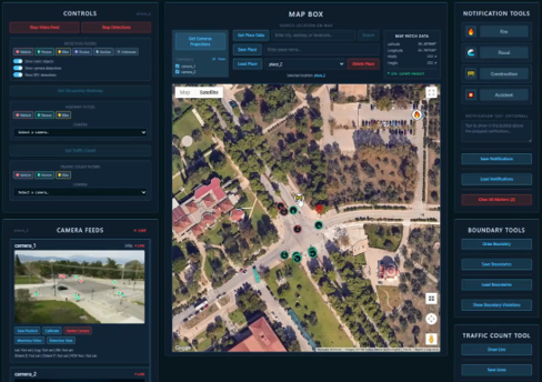
Key Customers: AviSense is developing its downstream space customer base, focusing on applications that combine satellite navigation and Earth observation with AI for mobility, operational safety and crisis management.
Affiliations/Memberships: ESA BIC Greece, si-Cluster, HASI
Facilities: N/A
Application Domain
Data, Applications & Digital Services, Dual-Use & Security Applications, Earth Observation & Geospatial Analytics, Mobility, Maritime & Aviation
Follow
Twitter / X